Located in the capital city, Srinagar Highway is one of the most important routes in the country. It is a major link between Islamabad and the northern areas. The highway was initially named after the disputed territory of Kashmir, however, it was renamed ‘Srinagar Highway’ recently to express solidarity with the people of occupied Kashmir.
Graana.com provides an overview of Srinagar Highway below, including a route guide, significance and other important facts.
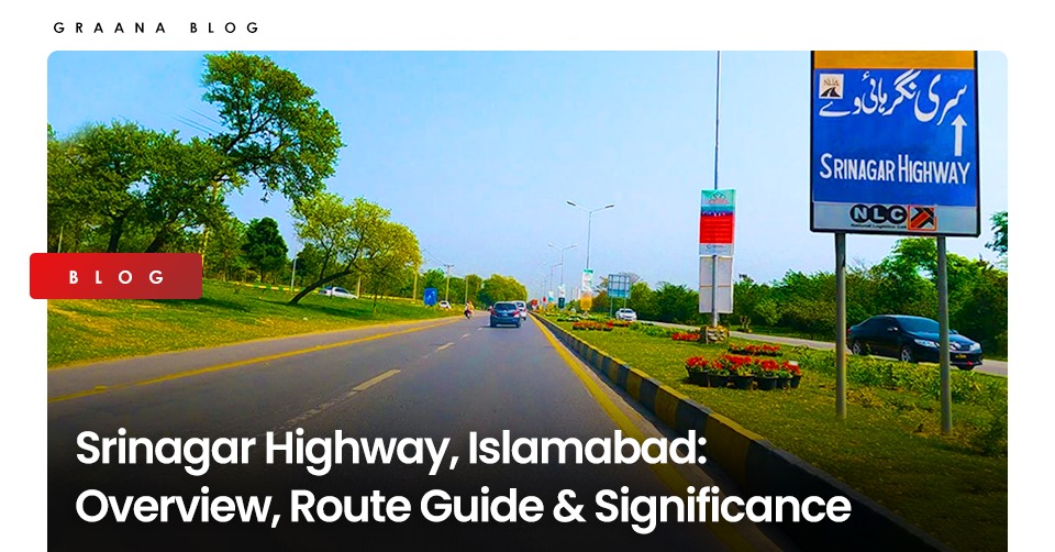
Srinagar Highway, also known as Shahrah-e-Srinagar, is a multi-lane, two-way expressway and one of the longest roads in Islamabad, covering a distance of 25 kilometres (16 miles). The well-maintained green belts alongside the whole road further add to its charm.
There are several significant junctions and intersections along Srinagar Highway, which runs through the centre of the city. It has a direct connection to Islamabad International Airport on its western end. On the other hand, Islamabad’s connection to the Murree Road interchange lies at the eastern end of the highway. As a result, it ranks as one of the most significant intercity routes in Islamabad.
The road is used by thousands of residents every day for commuting. There are navigational sign boards throughout the entire route to assist them. To maximise security and safety, there are also many CCTV surveillance cameras and police patrol points on this route. The Islamabad Traffic Police manage the traffic on Srinagar Highway, whereas the security is looked after by the Capital Territory Police.
A major benefit is that there are several metro bus stations present on this route to provide affordable and hassle-free public transportation to the residents of the twin cities. The road is also directly linked to many important landmarks and other places to visit in Islamabad, including Shakar Parian and Lake View Park.
Residents also have easy access to the Pakistan Secretariat, Serena Hotel and other key areas of the city through this highway. It is also in close proximity to some renowned universities, such as Allama Iqbal Open University, National University of Science and Technology, and National University of Computers and Emerging Sciences.
Recently, Srinagar Highway was upgraded to a signal-free expressway, in order to reduce travelling time and overcome traffic issues.
Here are some important facts about the Srinagar Highway.
The Shahrah-e-Srinagar route in Islamabad is connected to some prominent road connections and monuments of the city via a number of junctions and crossroads. Some of the most significant ones are listed below:
The 27-kilometre line 2 departs at the Srinagar Highway metro station and travels parallel to the highway before coming to an end at the Islamabad International Airport. The bus stops along line 2 of the metro bus route are as follows:
Visit the Graana Blog for more related information like Zero Point Islamabad and G-15 markaz.
Islamabad: The chairman of the Capital Development Authority (CDA) and Chief Commissioner Islamabad, Muhammad Ali…
Peshawar: The Khyber Pakhtunkhwa government is exploring plans to construct a 31-kilometre outer ring road…
Islamabad: The National Highway Authority (NHA) has spent more than half of its development budget…
Karachi: A high-level meeting chaired by Sindh Minister for Local Government Syed Nasir Hussain Shah…
Riyadh: Saudi Real Estate Co. (Al Akaria) has signed a long-term lease agreement with Amsa…
Rawalpindi: The divisional administration has begun acquiring land for the Rs5 billion Thalian Interchange, a…
Welcome to Graana Blog - Pakistan’s Smartest Property Portal!
For more than a decade our intention has been to revolutionise the real estate industry in Pakistan. The same belief drove the vision of our real estate team, Graana where quality beats quantity.
We have introduced an extremely transparent and purposeful portal where we will help you buy, rent or sell your property. A place where you can sit back relax and let us market your projects and listings. We believe we have set new standards for the future of real estate in Pakistan by providing the smartest property portal.


