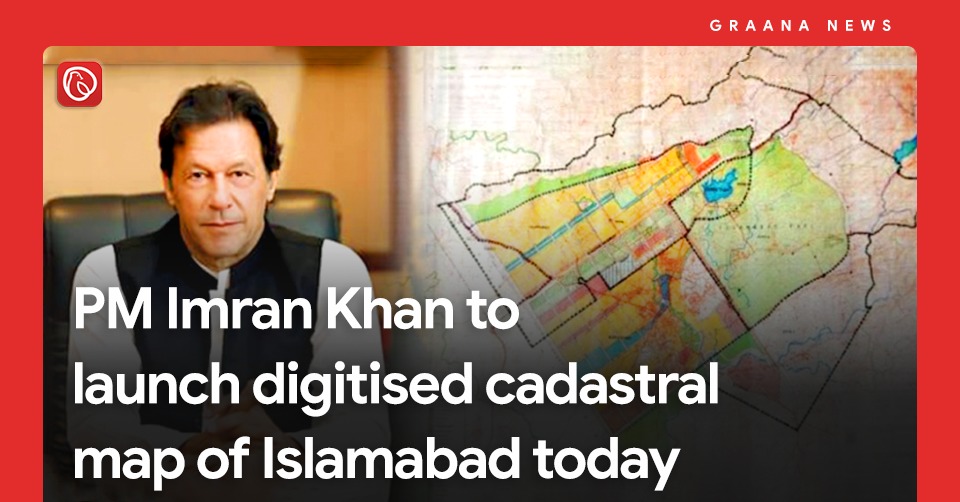
ISLAMABAD: Prime Minister Imran Khan is set to launch Islamabad’s digital cadastral map today.
The initiative aims to control the tampering of land records and monitor ongoing construction projects through extensive imagery to provide accurate and updated information about land ownership through a single click, especially for the overseas Pakistanis.
The task to digitise the old Patwar system into a modernised one was given to the Survey of Pakistan. Under phase 1 of the initiative, the sole national mapping and land surveying government agency of Pakistan was assigned to digitise revenue records of three major cities, including Karachi, Lahore and Islamabad and state land data of the country costing Rs1994 million.
A total of 70 sectors and 63 societies in CDA and 112 mouza in the Federal Capital have been digitised using the Geographical Information System (GIS).
Out of the 943 sq. km digitised, 400 sq. km belongs to CDA and 543 sq. km to ICT rural areas. As per the released date, a total of 1512 Kanal land is encroached, whereas 5350 Kanal area is varying from CDA layout plans.
For news and blogs, visit Graana.com.
DUBAI: Pakistani real estate developers and representatives showcased a range of commercial and residential investment…
ISLAMABAD: Capital Development Authority (CDA) is currently undertaking a major Rs652 million project to upgrade…
Karachi – Mayor Barrister Murtaza Wahab has announced the launch of a citywide anti-encroachment operation…
ISLAMABAD: CDA Chairman Muhammad Ali Randhawa has directed the immediate restoration of 23 non-functional water…
ISLAMABAD: In a major relief for the real estate sector, the federal government has decided…
DHA Islamabad-Rawalpindi (DHAI-R), one of the most trusted names in Pakistan’s real estate landscape, is…
Welcome to Graana Blog - Pakistan’s Smartest Property Portal!
For more than a decade our intention has been to revolutionise the real estate industry in Pakistan. The same belief drove the vision of our real estate team, Graana where quality beats quantity.
We have introduced an extremely transparent and purposeful portal where we will help you buy, rent or sell your property. A place where you can sit back relax and let us market your projects and listings. We believe we have set new standards for the future of real estate in Pakistan by providing the smartest property portal.
