Mangla Dam is a multipurpose water reservoir situated on the Jhelum River in the state of Azad Jammu and Kashmir. It has been instrumental in the agricultural, industrial, and energy sectors of Pakistan since its construction in 1967. In this blog, Graana.com explores the history, construction, significance, and impact of the dam.
History of Mangla Dam

The need for a large water reservoir in the Jhelum Valley was first recognised by the Pakistani government in the 1950s. The proposal for the dam was put forward in 1959, and its construction began in 1961.
It was completed in 1967, and its reservoir started filling the same year. The construction of the dam was a joint venture between the Pakistani government and the World Bank.
Key Points of Mangla Dam
| Location of Mangle Dam | Mangla Dam is located on the Jhelum River in the Mirpur District of Jammu & Kashmir, Pakistan. |
| Status | The dam is operational. |
| Type | The Mangla Dam is an embankment dam. |
| Local Name | The dam is locally known as “منگلا بند”. |
| Year of Completion | The construction of the dam began in 1961 and was completed in 1967. |
| Height | The height of the dam is 147 m (482 ft). |
| Length | The dam is 3,140 m (10,302 ft) long. |
| Reservoir | The dam creates the Mangla Lake. |
| Total Capacity | The total capacity of the reservoir is 9.12 km3 (7,390,000 acre·ft). |
| Surface Area | The surface area of the reservoir is 97 sq mi (251 km2). |
| Power Generation | The dam has 10 turbines with a capacity of 100 MW each. The installed capacity is 1,150 MW with a 15% overload capacity. The maximum planned capacity is 1,500 MW. |
| Construction Cost | The total cost of constructing the dam was Rs. 15.587 billion (US$1.473 billion). |
| Funding Sources | Funding for the dam was provided by the World Bank and the Asian Development Bank. |
| Components | The components of the dam include the main embankment, intake embankment, main spillway, emergency spillway, intake structures, and 5 tunnels. |
Construction of Mangla Dam

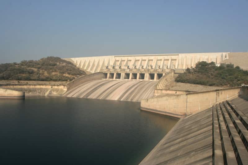
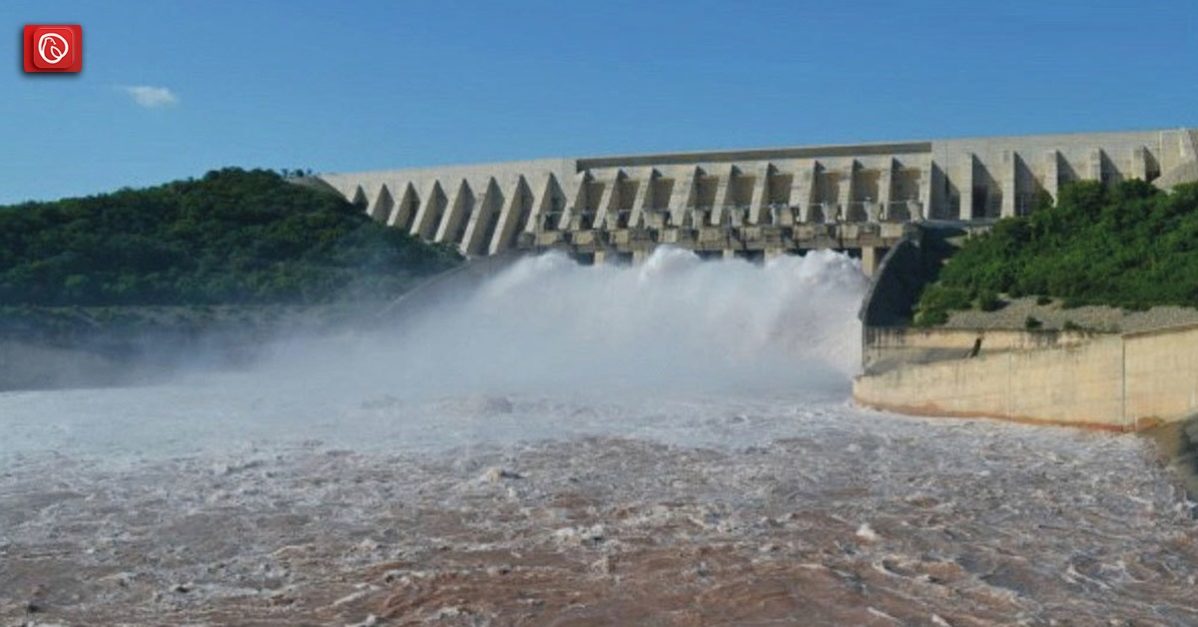
The Mangla Dam, one of the largest dams in Pakistan, is an earth-filled embankment dam with a height of 147 metres and a length of 3,140 metres. Its crest width is 30 metres, and it has a maximum storage capacity of 7.4 billion cubic metres. Its construction involved the excavation of over 68 million cubic metres of earth and rock.
It has two spillways, each with a capacity of 300,000 cubic metres per second. The spillways are controlled by eight radial gates, each 18 metres wide and 16 metres high. It also has four power generation units with a combined capacity of 1,000 megawatts.
Significance of Mangla Dam
The Mangla Dam is a vital component of Pakistan’s water and energy infrastructure. It has several major benefits, including:
Irrigation
It provides irrigation water to over 2 million acres of farmland in the Jhelum and Chenab river basins. This has led to the growth of cash crops like wheat, rice, and sugarcane. The dam has been instrumental in increasing agricultural productivity and improving the livelihoods of farmers.
Hydroelectric Power Generation
Its four power generation units produce 1,000 megawatts of electricity, which is distributed to the national grid. The dam’s power generation capacity has been crucial in meeting Pakistan’s growing energy demands and reducing its reliance on fossil fuels.
Irrigation Support
One of the main purposes of the Mangla Dam is to offer water for irrigation, thereby improving agricultural productivity in the surrounding areas. The water saved is released into the Jhelum River, facilitating irrigation and reaping crops.
Flood Control
The Mangla Dam plays a key role in flood control with the help of regulating the Jhelum River surge. During intervals of heavy rain or potential flooding, the dam can quickly accumulate excess water, helping to mitigate the effect of flooding downstream.
Recreation and Tourism
The reservoir created across the Mangla Dam also serves as a recreational area, attracting tourists and providing opportunities for sports including boating and fishing. The picturesque surroundings make it a destination for nature lovers and tourists.
Mangla Dam Power Generation Capacity
| Mangla Dam | |
|---|---|
| Surface area | 250 km2 (97 sq mi) |
| Power Station | |
| Turbines | 8 x 100 MW 2 x 135 MW |
| Installed capacity | 1,070 MW (operational) 1,310 MW (planned) |
Flood Control
The reservoir has a flood storage capacity of 5.88 billion cubic metres, which helps in controlling floods in the basin of the Jhelum River and reducing the loss of life and property.
Tourism
The dam’s scenic beauty and recreational facilities have made it a popular destination among tourists for picnics, boating, and fishing. Boosting tourism has helped in providing employment opportunities and contributing to the local economy.
Reservoir of Mangla Dam
The Mangla Dam’s reservoir, also known as the Mangla Lake, is the largest artificial lake in Pakistan, with a surface area of 260 square kilometres. The lake stretches for over 40 kilometres and has a maximum depth of 120 metres.
The lake has become a popular tourist destination, and provides opportunities for boating, fishing, and water sports, attracting visitors from all over the country.
Moreover, it has significant ecological value, providing a habitat for a wide range of species. The lake’s ecosystem supports several species of fish, including Rohu, Catla, and Mrigal. Its shores are also home to various species of birds, including herons, kingfishers, and cormorants. The authorities treat and supply the water from the lake to the local population, serving as a vital resource for their daily needs.
However, the construction of the Mangla Dam has affected the ecology of the lake. The fluctuation of the lake’s water level has impacted the natural habitat of the aquatic species. Additionally, human encroachment and deforestation have also affected its shorelines. The authorities have taken measures to protect the lake’s ecology, including reforestation programs, fishing regulations, and awareness campaigns.
Cost of Construction
The total cost of the project was estimated at $1.5 billion, with the World Bank contributing $100 million. The cost of the project included the construction of the dam, the excavation of over 68 million cubic metres of earth and rock, the installation of power generation units, the construction of irrigation canals, and flood control measures. The construction cost was significant, but the dam’s benefits have far outweighed the initial investment.
Turbine
The Mangla Dam has six power generation units, each equipped with a turbine capable of producing 100 MW of electricity. The turbines were supplied by Voith Hydro, a leading manufacturer of hydroelectric equipment.
The flow of water drives a turbine, which, in turn, rotates a generator to produce electricity. The turbines of the Mangla Dam utilize water from the Jhelum River, which is redirected through the dam’s intake towers to reach the turbines.
In addition, the Mangla Dam’s power generation units are run by the Water and Power Development Authority (WAPDA), which is responsible for managing Pakistan’s water and energy infrastructure. The turbines of the Mangla Dam produce electricity to meet Pakistan’s growing energy demands, providing a reliable and affordable source of power.
Total Output of the Mangla Dam
Based on data collected in 2009, the Mangla Dam has generated a total of 183,551 billion low-cost hydroelectric energy units since its establishment. In the 2008-2009 period, the dam produced an annual output of 4,797,425 million kilowatt-hours, while also serving a peak load of 1,150 megawatts, representing 8.18% of the total system’s peak load for WAPDA.
For more information, read Mangla Cantt or visit Graana.com,


