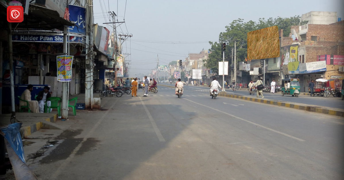
The city is known locally as مورو in Sindhi and مورو in Urdu, is in the Naushahro Feroze District. Moro is situated along the National Highway (N5) at the crossroads of Sindh, making it a pivotal hub for travellers and a bustling centre of commerce.
The distance of Moro from the river Indus is 12 km. With a population of approximately 368,789, as recorded in the 2017 Census of Pakistan, Moro is the largest city in the Naushahro Feroze District. Join us on a journey as Graana.com delve into the enchanting world of Moro, Sindh, and discover the hidden treasures that await in this captivating city.
Topography of Moro

Geographical Coordinates: Moro is situated at 26.665 degrees latitude and 68.002 degrees longitude.
- Elevation: The city has an elevation of 141 feet above sea level.
Within 2 Miles of Moro
- Flat Terrain: The topography within a 2-mile radius of Moro is predominantly flat.
- Elevation Change: The maximum elevation change in this area is just 62 feet.
- Average Elevation: The average elevation above sea level in this vicinity is 136 feet.
- Cropland: Covers 76% of the land.
- Artificial Surfaces: Make up the remaining 24%.
Within 10 Miles of Moro
- Flat Terrain: The topography within a 10-mile radius of Moro remains essentially flat.
- Average Elevation: The average elevation above sea level in this extended region is 115 feet.
- Cropland: Dominates the landscape, covering approximately 83% of the land.
50 Miles of Moro
- Modest Elevation Variations: Even within a broader area of 50 miles from Moro, the topography exhibits only modest variations in elevation.
- Average Elevation Change: The average elevation change within this wider vicinity is 3,547 feet.
- Cropland: Remains a prominent feature, covering 50% of the land.
- Bare Soil: Accounts for 40% of the terrain.
Best Time to Visit Moro

Moro offers favourable weather conditions for tourists at different times of the year, depending on the type of activities you prefer. If you enjoy general outdoor tourist activities, consider visiting from early February to mid-March and from late October to mid-December, with the second week of November being particularly pleasant.
On the other hand, if you’re looking for hot-weather activities like beach and pool relaxation, plan your trip from late September to early November, with the second week of October being the peak period for such endeavours.
The best times to visit Moro is based on weather conditions. It can be determined by considering two travel scores: the tourism score and the beach/pool score.
- Tourism Score: This score favours clear, rainless days with perceived temperatures between 65°F and 80°F. According to this score, the ideal times for general outdoor tourist activities in Moro are:
- Early February to Mid-March: This period offers pleasant weather conditions, making it suitable for exploring outdoor attractions and engaging in various tourist activities.
- Late October to Mid-December: Similarly, late October through mid-December provides favourable weather for outdoor exploration, offering a comfortable climate for tourists.
- Peak Score in Second Week of November: The second week of November stands out as an optimal time during these periods, with the highest score, indicating the most pleasant weather conditions.
Moro Weather and Climate
Moro experiences sweltering summers, mild winters, and distinct wet and dry seasons. The climate exhibits significant variation in temperature, humidity, and wind patterns throughout the year, making it essential for travellers to consider these factors when planning their visits to Moro.
Moro experiences distinct climate characteristics and weather conditions throughout the year. Here is an overview of the climate and weather in Moro:
Temperature
- Seasonal Variation: Moro has sweltering and humid summers and short, cool winters.
- Temperature Range: The temperature typically varies from 46°F to 113°F throughout the year.
- Hottest Month: June is the hottest month, with an average high of 112°F and a low of 84°F.
- Coldest Month: January is the coldest month, with an average low of 47°F and a high of 75°F.
Cloud Cover
- Clear Period: The clearest part of the year in Moro is from late August to mid-March, with October being the clearest month.
- Cloudy Period: Moro experiences cloudier conditions from mid-March to late August, with July being the cloudiest month.
Precipitation
- Wet Season: The wet season in Moro lasts for approximately 1.8 months, from July to early September, with August having the most wet days.
- Dry Season: The dry season spans 10 months, from September to July, with November having the fewest wet days.
Rainfall
- Rainy Period: The rainy period of the year in Moro is from July to mid-September, with August being the rainiest month.
- Rainless Period: The rainless period extends from mid-September to early July, with November having little to no rainfall.
Sunlight
- Daylight Hours: The length of the day in Moro varies throughout the year, with the longest day occurring on June 21 and the shortest on December 22.
- Sunrise and Sunset: The earliest sunrise is at 5:33 AM in June, while the latest sunrise is at 7:18 AM in January. The earliest sunset is at 5:34 PM in December, with the latest sunset at 7:25 PM in July.
Humidity
- Seasonal Variation: Moro experiences extreme seasonal variation in perceived humidity.
- Muggy Period: The muggier period lasts for about 4.3 months, from May to September, with July being the most humid month.
- Dry Period: January is the month with the fewest muggy days.
Wind
- Wind Speed: Moro’s average hourly wind speed varies significantly by season.
- Windiest Months: The windiest period occurs from May to September, with July being the windiest month.
- Calm Months: The calmest months are from September to May, with November having the lowest average wind speed.
- Wind Directions: Wind patterns vary, with westerly winds from March to May, southerly winds from May to October, and northerly winds from October to March.
Moro to Karachi Distance
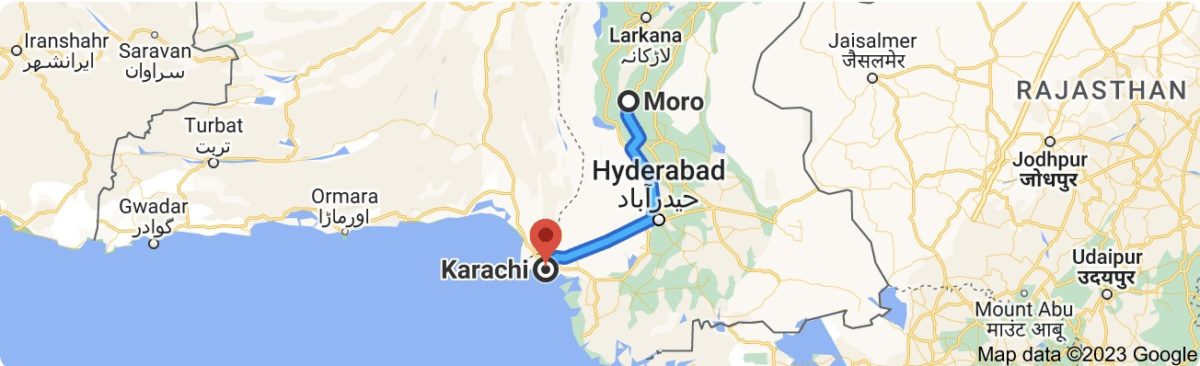
The distance from Moro to Karachi is a journey that spans approximately 138 miles (222.09 kilometres) by road, which equates to roughly 119.92 nautical miles for those who prefer to navigate the seas. When planning your road trip, it’s important to consider not just the distance, but also the driving time. In this case, the estimated driving time from Moro to Karachi is around 4 hours.
However, it’s advisable to factor in additional time for rest stops, refuelling, and perhaps grabbing a bite to eat along the way to ensure a comfortable and safe journey. Alternatively, for those seeking a quicker way to reach Karachi from Moro, you can opt for a flight. The flight time for this route is approximately 46 minutes, making it a convenient choice for those who prioritize speed and efficiency.
As you embark on this road trip adventure, you can break up your journey by stopping in notable cities along the way. Starting in Moro, you’ll drive for about 2 hours until you reach Hyderabad, where you can take a break and explore the city for an hour.
Continuing your drive for another 2 hours will lead you to Clifton, providing another opportunity to stretch your legs and enjoy a brief rest for an hour. Finally, a short 14-minute drive will bring you to your destination, Karachi, where you can savour all that this bustling metropolis has to offer.
Moro to Hyderabad Distance

The distance between Moro and Hyderabad, two cities located in Pakistan, can be measured in both flying distance and driving distance. The coordinates for Hyderabad are 25.3924°N latitude and 68.3737°E longitude, while Moro’s coordinates are 26.6646°N latitude and 68.0016°E longitude.
The calculated flying distance between Hyderabad and Moro is approximately 91 miles (146 kilometres). This distance is typically covered by air travel.
However, if you prefer to travel by car, the driving distance between Hyderabad and Moro is approximately 166.17 kilometres (about 103 miles). Assuming an average driving speed of 112 kilometres per hour (70 miles per hour), the estimated travel time by car is approximately 1 hour and 29 minutes. It’s important to note that the actual travel time may vary depending on factors such as road conditions and traffic.
Moro to Sukkur Distance
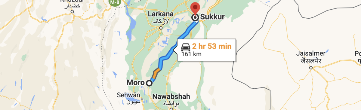
The distance between Moro and Sukkur, two cities in Pakistan, can be measured both in flying distance and driving distance. Moro’s coordinates are approximately 26.6646°N latitude and 68.0016°E longitude, while Sukkur’s coordinates are approximately 27.7052°N latitude and 68.8574°E longitude.
The calculated flying distance from Moro to Sukkur is approximately 89 miles (143 kilometres). This distance represents the direct aerial distance between the two cities.
For those opting to travel by car, the driving distance between Moro and Sukkur is slightly longer, measuring approximately 156.31 kilometres (97 miles). Assuming an average driving speed of 112 kilometres per hour (70 miles per hour), the estimated travel time by car is approximately 1 hour and 23 minutes. Keep in mind that actual travel times may vary due to factors such as road conditions and traffic.
For more details visit Graana.com.