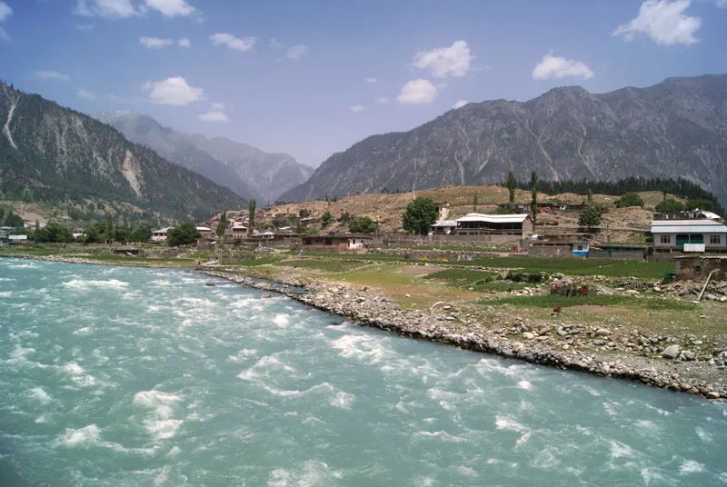
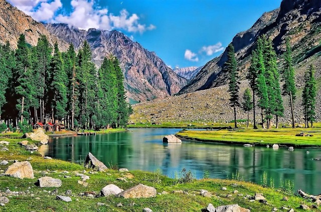
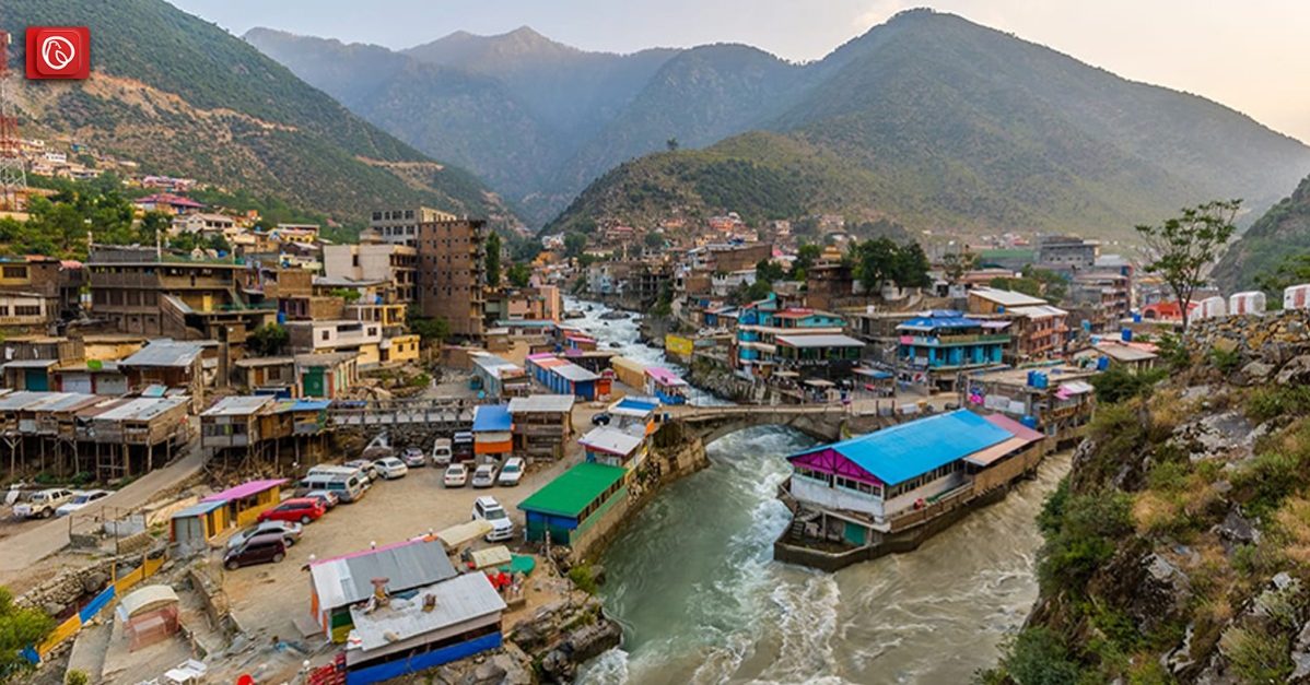
The Swat River is a captivating perennial river nestled in the enchanting northern region of Khyber-Pakhtunkhwa Province, Pakistan. With its origins traced back to the high glacial valleys of the majestic Hindu Kush mountains, the Swat River meanders through the scenic Kalam Valley before becoming the backbone of the wider Swat Valley – an esteemed tourist destination known for its breathtaking beauty and historical significance as the ancient Gandhara region, adorned with numerous ancient Buddhist sites.
Graana.com shares all the details about the Swat River and the economic impact of the river.
Origin of Swat River Name
The name “Swat” has intriguing origins. One theory suggests that it could have originated from the Sanskrit word “shveta,” meaning “white,” possibly describing the crystal-clear waters of the river.
Another notion derives from the Sanskrit term implying “clear blue water.” Ancient Greeks knew this river as “Soastus,” while the Chinese pilgrim Faxian referred to it as “Su-ho-to.”
The Birth of Swat River

The Swat River, one of the most famous rivers in Pakistan, originates from numerous tributary streams, each arising from distinct tributary valleys. As these tributaries merge, they give birth to the main river, which gradually flows southwards from the village of Madyan.
The 70 km long drainage basin forms the heart of the river, characterised by vast alluvial plains with fertile and productive soils. The tributary valleys contribute to this fertility through alluvial and colluvial deposits left by the eroding streams.
The Scenic Bank of Swat
The region surrounding the river’s southward journey is blessed with gently sloped mountains and shallow to intermediate soils. These valleys, situated on both sides of the River Swat, benefit from ample precipitation, making them highly productive and densely populated. The abundant vegetation thrives in this area, creating a lush and scenic environment.
In contrast, the intermountain basin towards the north of Madyan (Kohistan) presents a different landscape. Here, rocky, rugged, and complex mountains, along with narrow valleys, define the region. The mountains have steep slopes, and the peaks often have glacial coverings.
The summer rainfall is relatively lower in this area, and the population is sparse. The elevated regions beyond the tree line (3500-5000 metres) serve as summer grazing pastures.
A Journey Through Towns and Villages

The River flows gracefully and it connects numerous towns and villages on both sides. These settlements are interconnected by a network of roads and telecommunication services. On the western bank, villages like Chakdara, Shamozai, Kabai, Kanju, Koza Bandai, and many others thrive alongside the river.
On the eastern bank, one can find the charming villages of Totakan, Khar, Batkhela, Thana, Kota, and Ghalagay, among others, situated in the south of Mingora.
Further north, the villages of Manglawar, Charbagh, Khwazakhela, Fatehpur, and Madyan add to the allure of the river’s surroundings. These settlements bear witness to the historical and cultural significance of the Swat Valley.
Roads and Bridges Alongside Swat River
To facilitate transportation and connectivity, parallel roads run on both sides of the River Swat. On the eastern bank, the main GT Road takes travellers to Totakan in the south and Bagh Dherai in the north, just south of Madyan.
The western bank road functions as an ordinary service road, providing essential access to the surrounding tributary valleys of Sakhœ, Matta, Shawar, Nikpikhel, and Khazana.
Bridges play a vital role in linking the two sides, and travellers can cross the river through well-established bridge points near Totakan, Chakdara, Barikot, Kanju, Khwazakhela, and Bagh Dherai. This comprehensive network enhances accessibility and supports the region’s development.
SWAT River lakes
The river in Swat is home to a number of beautiful lakes in Pakistan, each with its own unique charm. Here is a brief overview of some of the most popular lakes in the Swat River Valley:
Spin Khwar Lake
Situated in the upper Swat Valley near the charming village of Bahrain, holds an esteemed place among the region’s lakes. Its tranquil waters entice visitors for fishing and boating excursions, creating unforgettable moments amid the stunning backdrop of the Swat Valley’s natural beauty.
Andarab Lake
A hidden gem located in the enchanting Kalam Valley near the village of Anakar might be smaller in size but promises seclusion and tranquillity. Far away from the hustle and bustle, this lake provides an ideal sanctuary for those seeking solace amidst nature’s embrace.
Daral Lake
In the Utror Valley, the awe-inspiring Daral Lake awaits travellers with its grandeur. Nestled near the village of Daral, this vast expanse of water reflects the majestic mountains surrounding it, creating a mesmerising sight that lingers in the hearts of all who visit.
Izmis Lake
For those seeking a smaller, yet equally enchanting destination, Izmis Lake in Kalam Valley, near the village of Izmis, captivates with its crystal-clear blue waters. The serenity of this lake provides a perfect backdrop for those seeking to immerse themselves in the lap of nature.
Mahodand Lake

Nestled near the village of Mahodand, is a paradise for adventure seekers. A popular spot in Swat for hiking and camping, this lake combines the thrill of exploration with the serene beauty of the Swat Valley.
Khaipro Lake
Located in the Upper Swat Valley near Khajr village, exudes an ethereal charm in its compact setting. Surrounded by the breathtaking scenery, it offers an ideal escape for those yearning to connect with nature in a more intimate setting.
Bashigram Lake
Another gem in the Upper Swat Valley near Bashigram village, showcases the clearest blue waters, captivating the hearts of all who witness its magnificence. This vast lake reflects the azure sky, making it a sight to behold.
Kandol Lake
This lake in the Utror Valley, near Kundol village, beckons fishing and boating enthusiasts with its allure. Providing a tranquil setting amidst nature’s wonders, it is an ideal location to unwind and rejuvenate the soul.
Beyond these well-known lakes, the Swat Valley also houses numerous smaller lakes and ponds that serve essential purposes, including irrigation and providing drinking water to the local communities. However, even these smaller bodies of water possess a beauty that captivates the heart.
Economic Impact
The river plays a pivotal role in the region’s economy. It facilitates irrigation in the lower reaches of the Swat and Malakand Valley. A network of canals regulated by the Amandara Headworks, which was established by the British in 1903 facilitates irrigation in the area.
The ingenious Benton Tunnel, constructed in 1914, allows the Swats Canal to pass under the Malakand Pass. Downstream from Dargai, the British-built Munda Headworks (1921) supplies canals that nourish various smaller canals in the districts of Charsadda, Swabi, and Mardan in the Peshawar Valley. Moreover, the river significantly contributes to recharging water wells and springs through seepage, supporting local agricultural practices.
Harnessing Hydropower
The water resources are harnessed for hydropower generation, driving progress and development in the region. The Jabban Hydropower Plant, completed in 1938, and the Dargai Hydropower Plant, completed in 1952, stand as testaments to human ingenuity, providing a significant portion of the region’s electricity needs.
The ambitious Mohmand Dam is located at the lower end of the river’s course before it enters the Peshawar valley. Under construction dam promises to generate an impressive 740 MW of power once operational. Additionally, several proposed hydropower projects, including the Asrit Kedam HPP, Gabral HPP, and Matiltan HPP, hold the potential to further augment the region’s power generation capacity.
Conclusion
The Swat River, with its mesmerising journey from the glacial valleys of the Hindu Kush mountains to the fertile plains of the Swat Valley, is not only a source of scenic delight but also a vital lifeline for the local communities. Its significance in the economy, agriculture, and power generation cannot be overstated.
For more information on touristic places like Chota Lahore, Visit Graana.com
FAQs
Is the Swat River only significant for its scenic beauty?
The river is not only admired for its scenic beauty but also plays a crucial role in the region’s economy, agriculture, and hydropower generation.
What are the proposed hydropower projects along the Swat River’s course?
Some of the proposed hydropower projects are Asrit Kedam HPP, Gabral HPP, and Matiltan HPP.
Where does the Swat River find its source?
The river originates from the high glacial valleys of the Hindu Kush mountains.
What is the historical significance of the Swat Valley?
The Swat Valley was a prominent part of the ancient Gandhara region, housing numerous ancient Buddhist sites of great historical importance.
How does the Swat River impact the local economy?
The river facilitates irrigation through a network of canals, contributing significantly to agricultural practices and the region’s economy.
For more details, visit Graana blog.
Read More


